NZ Maps

31 results
The NZ Map Wooden Keyring features a handmade New Zealand map design with green patterns and comes attached to packaging labeled Handmade Keyring NZ Map.
The NZ Map Wooden Magnet is a handmade wooden magnet shaped and colored like the map of New Zealand, attached to a brown card labeled HANDMADE MAGNET and NZ Map.
The 
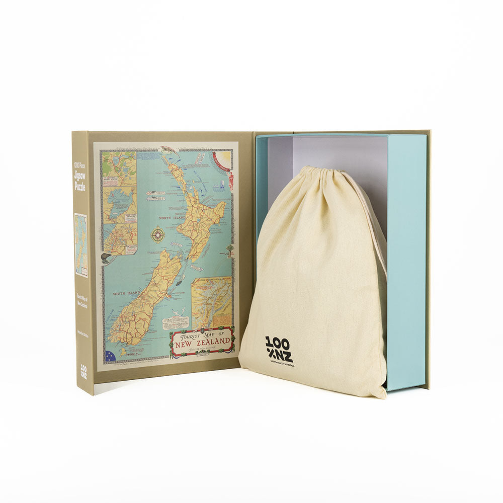
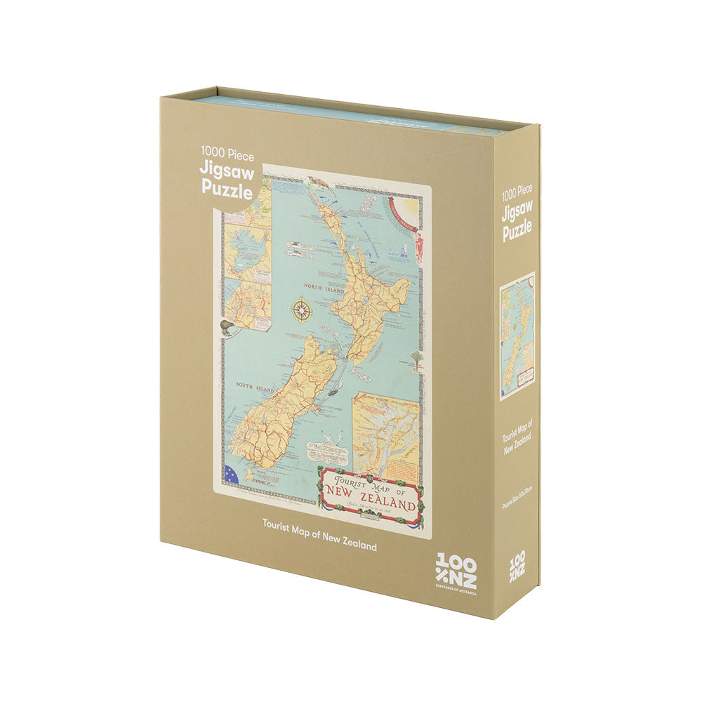
Tourist Map of NZ Jigsaw Puzzle Box features a blue and orange box with a vintage New Zealand map inside the cover, plus a beige drawstring cloth bag—ideal for any New Zealand jigsaw puzzle enthusiast.
The NZ Map A2 Print features a vintage-style map of New Zealands North and South Islands with colorful region outlines and labeled places, ideal as wall art or an art print, all centered on a crisp white background.
NZ Map A2 Print
From $69.00
The Map of New Zealand Wall Chart features a vintage-style display of the North and South Islands with labeled regions, cities, and major landmarks in a wooden frame with hanging string. Made in New Zealand.
The New Zealand Tourist Map Wall Chart displays the North and South Islands with illustrated details, inset maps, and labeled towns—ideal as instant decorative art for any space.
The NZ Dominion Map Wall Chart is a vintage-style topographic map of New Zealand featuring elevation, major cities, and nearby waters. Ready to hang in a wooden frame, it includes a small inset map at the bottom right.
The Auckland Mapscape Foil Print, a black-framed picture with gold map lines on a black background, brings contemporary flair to white decor, displayed upright against a light wall and resting on a white surface.
The Wellington Mapscape Foil Print is a framed art piece featuring a circular map design with gold foil streets on a black background, displayed against a white wall.
The Christchurch Mapscape Foil Print features a black frame and a circular gold-foiled map of city streets on a black background, shown leaning against a white wall on a flat white surface.
The Northland Vintage Map Print showcases New Zealand’s North Island, highlighting the northern tip with labeled regions like Hokianga, Whangarei, Kaipara, and Bay of Islands, plus clearly marked towns, islands, and coastal details.
The Auckland Vintage Map Print displays a detailed lithograph of northern New Zealand’s North Island, featuring Auckland, Kaipara, Manukau Gulf, and Great Barrier Island, all with a classic white border.
The Taranaki Vintage Map Print is a detailed lithograph showing New Zealand’s Taranaki region, with labeled towns like New Plymouth, Stratford, and Hawera, plus coastal features and intricate geography.
The Hawkes Bay Vintage Map Print is a detailed lithograph of New Zealand’s North Island, featuring Hawke Bay, Bay of Plenty, East Cape, and surrounding towns. Beautifully presented in a white frame.
A close-up of the Central Plateau Vintage Map Print, a stunning Giclee lithograph showcasing New Zealand’s Taupo region with English-labeled towns, lakes, rivers, and colorful shaded terrain features.
The Waikato Vintage Map Print features a vintage lithograph of New Zealand’s Waikato region, highlighting cities such as Hamilton, Raglan, Kawhia, Huntly, and Thames with labeled rivers and neighboring areas.
The Raglan Vintage Map Print is a close-up of a 19th-century lithograph showing New Zealands North Island, featuring place names like Hamilton, Raglan, Waikato, and Kawhia with colored boundaries and vintage typography.
A detailed view of the Wellington Vintage Map Print—a 19th Century lithograph map of New Zealands North Island, highlighting Wellington, Manawatu, Wairarapa, and nearby towns. The giclee print comes with a white mat frame.
A close-up of the Coromandel Vintage Map Print displays Great Barrier Island, Thames (Grahamstown), and surrounding areas of New Zealand, elegantly presented in a white square mat frame.
The Dunedin Vintage Map Print is a framed close-up of a vintage lithograph map featuring the southeastern coast of New Zealand, including Dunedin, Port Chalmers, Taieri, and Oamaru.
The Nelson Vintage Map Print is a vintage lithograph of New Zealand’s northern South Island, showing Nelson, Marlborough, and Golden Bay with clearly labeled towns, rivers, and mountains. The map is bordered by a white margin.
The Christchurch Vintage Map Print features a square-framed section of a 19th-century lithograph, showing coastal New Zealand with Christchurch, Lyttelton, Lincoln, Akaroa, Rangiora, Pegasus Bay, and other labeled locations.
The Westport Vintage Map Print is a 19th-century lithograph featuring New Zealand’s northwest South Island, highlighting towns like Nelson, Westport, Greymouth, and Hokitika with detailed borders and geographic features.
The Otago Vintage Map Print features a detailed close-up of historic New Zealand towns—Alexandra, Cromwell, Queenstown, and Kingston—with colored borders and rivers, making it an ideal giclee print for history lovers.
The Canterbury Vintage Map Print showcases a vintage lithograph of New Zealands South Island, highlighting Christchurch, Lyttelton, Timaru, detailed inland areas, and the sea edge—ideal as a giclee print for map collectors.
A close-up of the Te Anau Vintage Map Print, a 19th-century lithograph showing rivers, mountains, and colorful place names around western Scotland, including Fort William, Loch Linnhe, and nearby towns.
The Lower South Island Vintage Map Print is a colorful 19th-century lithograph featuring labeled towns, rivers, and geographic details of southern New Zealand with highlighted borders and place names.
The Stewart Island Vintage Map Print depicts southern New Zealand, including Fiordland, Invercargill, and surrounding waters, with labeled geographic features and towns in a classic lithograph style.
Auckland Mapscape: A black and white line map of Auckland, New Zealand, with detailed streets on 200gsm art paper in a white frame. Labelled Auckland Tāmaki Makaurau at the bottom.
New In
The Wellington Mapscape is a black and white line drawing of Wellington, New Zealand, featuring streets and coastlines. Printed with archival inks and displayed in a white frame, it’s labeled Wellington Te Whanganui-a-Tara at the bottom.
New In
The Christchurch Mapscape is a black and white line drawing of Christchurch, New Zealand, printed on 200gsm art paper with archival inks. Framed in white, it highlights the citys roads and waterways in grid and curve patterns, labeled at the bottom.
New In